The Physical Background
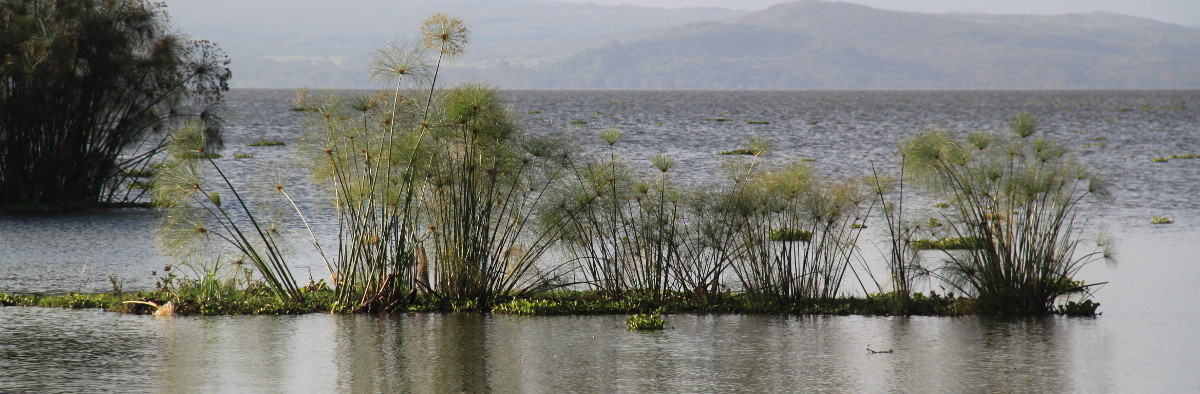
The Lake Naivasha Basin extends across ca. 3,400 squared km; it lies just below the Equator within the eastern branch of the Great Rift Valley (Gregory Rift), in the southern half of the former Rift Valley Province. The Nyandarua Range, a steep and heavily forested volcanic formation, which culminates at 4,001 m with the peak of Ol Donyo Lesatima (the young bull’s mountain), delineates its eastern limit. If we descend from here moving westwards, immediately below the Aberdares National Park boundary, at about 3000 m, forest is cleared and the land is divided into small farming plots where potato, carrot, cabbage and pea plantations grow on rich formerly forested soils. At 2500 m, the slope grades onto the Kinangop Plateau, one of the most productive smallholder farming areas supplying Naivasha and Nairobi. Further West, below 2200 m we encounter a much warmer and drier region overlaying permeable sandy soils derived from ancient lake deposits. Scattered acacias dominate the landscape used as common pasture by Maasai cattle herders. Naivasha Town is located in this dry area, at 2000 m a.s.l., some 5 km from the lake edge. A large number of tributaries drains the slopes of the Aberdares conveying water into the Malewa River, the major tributary to the Lake, which is surrounded by an extensive Yellow fever tree forest, and a papyrus belt bordering the water edge. A second stream, the Gilgil, reaches the lake from the North. Most of the region to the West of the Lake is similarly covered by dry to moist acacia and euphorbia dominated savannah with rare and scattered human settlements. Dense forest reappears only above 2700 m, at the north-western edge of the catchment, along the slopes of Eburru and Mau.